From Ancient Trade Routes to Weekend Paddle Boards — How the River Made Knoxville
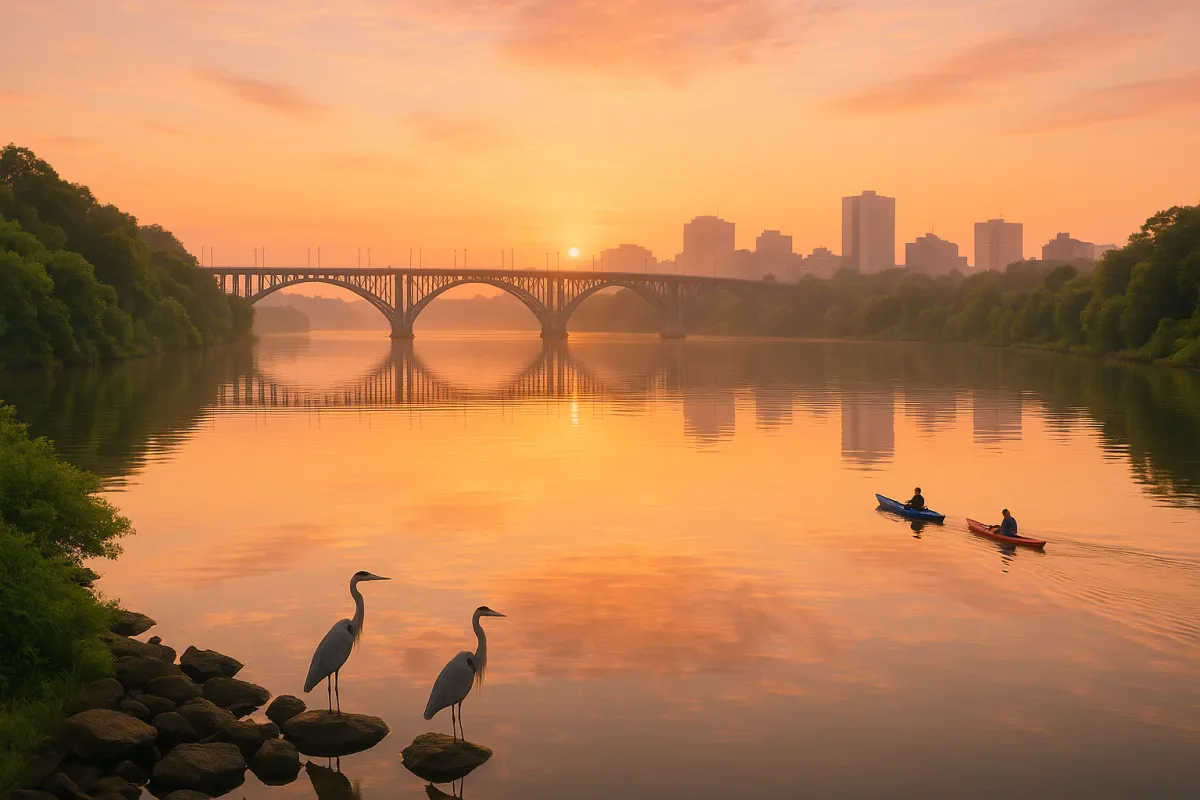
There is a moment, if you stand on the south bank of the Tennessee River just east of downtown Knoxville and look west toward the Gay Street Bridge, when the city's entire history seems to compress into a single view. The water is wide and quiet, moving with the unhurried confidence of something that has been here longer than any building, any road, or any name given to this place by any people. The glass of the downtown skyline catches the river's light. A kayaker cuts across the current. A heron stands motionless on the opposite bank.
The river made this city. Not metaphorically — literally. And to understand Knoxville, you have to understand the Tennessee River first.
The Geography That Made Everything Possible
The Tennessee River doesn't just pass through Knoxville — it is created here. At a point just east of the city, the Holston River and the French Broad River converge to form the Tennessee. This confluence, known locally simply as "the forks of the river," was one of the most strategically significant geographic locations in all of Appalachian America.
Native American peoples recognized this long before European explorers arrived. The Overhill Cherokee built trade networks that radiated outward from the river system, using the Tennessee and its tributaries as highways through a mountain landscape that would otherwise be nearly impassable. Fish were abundant. The bottomlands were fertile. The river offered both sustenance and connection to distant communities.
When James White arrived in 1786 and built his fort on the north bank, he was doing what intelligent settlers always did: he was following the water. The decision to place the city here, at the confluence of three rivers, was the founding geographic act from which everything else in Knoxville's history follows.
The River as a Commercial Artery
In the late 18th and early 19th centuries, before railroads existed and before roads through Appalachian terrain could reliably carry heavy freight, rivers were the interstate highways of commerce. The Tennessee River gave Knoxville access to trade routes that extended hundreds of miles in every direction.
Flatboats loaded with goods — corn, whiskey, iron goods, furs, salt — floated downriver from the Knoxville area toward Muscle Shoals in Alabama and, eventually, to the Mississippi River system and the port of New Orleans. Return trips brought manufactured goods and trade items from the wider world. Knoxville became a commercial hub not because of any particular genius of its founders, but because the river made it one.
The waterfront along the Tennessee's north bank was a working landscape of warehouses, boat landings, and merchant offices. The city's early wealth and civic ambition were built on the river trade. When the railroad arrived in the 1850s, it didn't replace the river so much as it augmented it, turning Knoxville into a multi-modal commercial node that dominated East Tennessee's economy for the next century.
Floods, Power, and the TVA's Transformation
The Tennessee River gave Knoxville commerce, but it also delivered periodic catastrophe. Before the 20th century, flooding was a persistent and sometimes devastating fact of life for riverside communities throughout the Tennessee Valley. The river's moods — swollen with spring rains or running dangerously high after mountain storms — were forces that the city could accommodate but never fully control.
The Tennessee Valley Authority changed that equation permanently when it began its dam-building program in the 1930s. By controlling the river's flow through a system of dams and reservoirs, TVA tamed the Tennessee in ways previous generations could not have imagined. Flooding was dramatically reduced. Hydroelectric power generated at the dams brought electricity to communities that had never had it. Navigation on the river was improved by consistent water levels maintained for barge traffic.
The dams also created lakes. Fort Loudoun Lake, the reservoir immediately west of downtown Knoxville, is a direct product of the TVA era — and it transformed the riverfront from an industrial working waterway into something far more complex: a resource for recreation, real estate, and civic identity.
The River and Recreation: A City Returns to Its Waterfront
For much of the mid-20th century, Knoxville — like many American cities — turned its back on its waterfront. Industrial and rail infrastructure separated downtown from the river. The banks were functional rather than beautiful. The river was something people crossed, not something they engaged with.
The reversal of that trend is one of the most significant quality-of-life stories in Knoxville's recent history. Today, the Tennessee River waterfront is arguably the most desirable recreational corridor in the city. The Volunteer Landing park and greenway along the south bank of Fort Loudoun Lake offers miles of paved trail connecting major landmarks and neighborhoods. Kayakers, paddleboarders, and recreational boaters are a constant presence on summer weekends. University of Tennessee crew teams glide along the water in the early mornings. Rowing regattas bring visitors from across the region.
Further west, Ijams Nature Center anchors the Urban Wilderness experience with trails that follow the river's contours and offer wildlife encounters — great blue herons, river otters, migratory songbirds — within a mile of the urban core. The river, in this stretch, feels genuinely wild.
For boaters, Fort Loudoun Lake and its connection to the larger Tennessee River system offers access to an extraordinary inland waterway network. The annual Boomsday festival — one of the largest Labor Day fireworks celebrations in the country — explodes over the river each September, drawing hundreds of thousands to the waterfront.
Development, Real Estate, and the River Premium
Rivers drive real estate. Always have, always will. In Knoxville, proximity to the Tennessee River — or to Fort Loudoun Lake, its western reservoir — carries a significant premium that shapes how and where the city develops.
The South Knoxville waterfront has been the focus of major redevelopment attention for the past decade. What was once an industrial and underutilized stretch of riverbank is being reimagined as a mixed-use corridor of restaurants, residences, and public spaces. The vision is ambitious: a true urban waterfront neighborhood that mirrors the vitality of downtown Knoxville while offering river access and views that the northern bank cannot match.
Waterfront residential development — condominiums, townhomes, and single-family homes along the lakeshore in communities like Concord, Farragut, and Turkey Creek on the western end of Fort Loudoun Lake — represents some of the most desirable and fastest-appreciating real estate in the Knoxville metro. People want to live near the water, and the Tennessee River system gives the region an abundance of opportunities to do exactly that.
The River as Identity
Ask Knoxvillians what they love about their city and the river comes up again and again — often in ways they don't fully articulate because it's so deeply embedded in daily life. The view of the Tennessee from the pedestrian bridge near Volunteer Landing. The morning fog sitting in the river valley before the city fully wakes. The way the water catches the orange of a sunset and throws it back into the sky.
The river is also a statement of regional identity. This is the Tennessee River — not the Cumberland, not the Ohio, not the Mississippi. It belongs to East Tennessee in a particular way, rising in these mountains, running through this city, carrying this history. Knoxville's relationship with the water is not incidental; it is definitional.
The Cherokee understood that. James White understood that. The TVA engineers understood that. And the weekend paddleboarders slipping silently past the downtown skyline on a quiet Sunday morning, whether they know it or not, are participating in a relationship between a city and its river that is as old as the idea of Knoxville itself.
Looking Downstream
As Knoxville continues to grow — and it is growing, steadily and purposefully — the Tennessee River will remain the organizing force behind where and how that growth happens. The South Knoxville waterfront development. The expansion of greenway trails. The ongoing conversation about public access and ecological stewardship. The question of how to balance recreational demand with the natural systems that make the river worth recreating on in the first place.
These are not abstract policy questions. They are the living continuation of a story that began when two mountain rivers merged in East Tennessee and a civilization — first Indigenous, then settler, then industrial, then post-industrial — organized itself around the confluence.
The water shaped the city. Now the city must decide how it will shape the water in return. That conversation, more than any stadium, any technology park, or any political decision, may be the most important one Knoxville has in the years ahead.
